


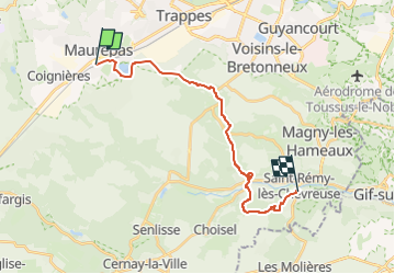
LA VERRIERE > ST REMY 18 KM

gemau77
User

Length
18.7 km

Max alt
185 m

Uphill gradient
307 m
Km-Effort
23 km

Min alt
77 m

Downhill gradient
397 m
Boucle
No
Creation date :
2019-03-18 15:02:19.238
Updated on :
2022-05-05 15:22:09.737
4h51
Difficulty : Unknown

FREE GPS app for hiking
 SityTrail
IGN / Geographical institutes
SityTrail Plus
The world is yours!
About
Trail Walking of 18.7 km to be discovered at Ile-de-France, Yvelines, La Verrière. This trail is proposed by gemau77.

Positioning
Country:
France
Region :
Ile-de-France
Department/Province :
Yvelines
Municipality :
La Verrière
Location:
Unknown
Start:(Dec)
Start:(UTM)
422366 ; 5400828 (31U) N.
Comments